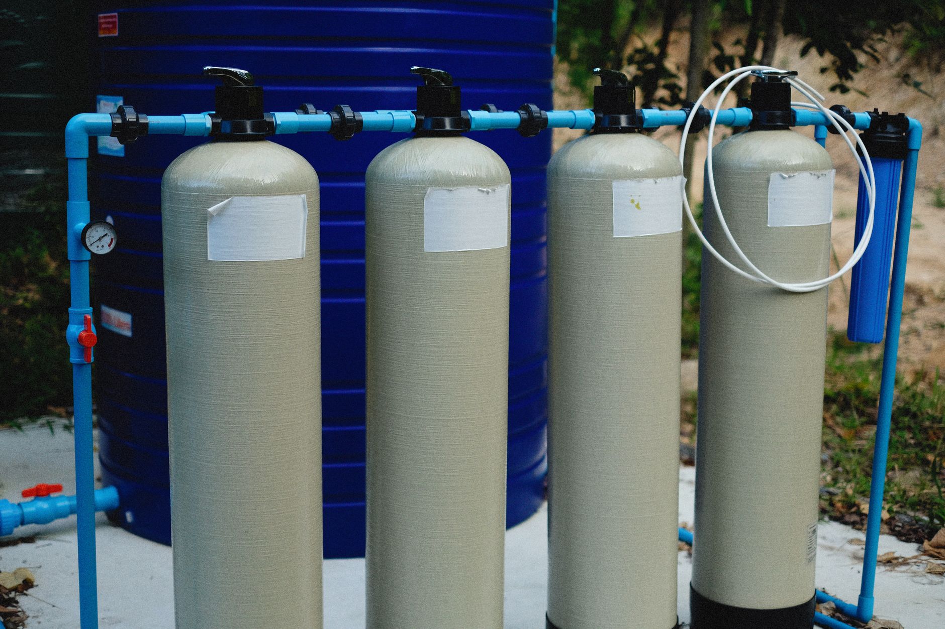
Dholera water infrastructure, as reported by DICDL for the Activation Area, includes a water treatment plant of about 50 MLD with reservoirs, a piped potable-water network with smart meters and leak detection, a separate recycled-water network, underground wastewater and effluent lines, and stormwater drained into a 6.5 km man-made canal. These are laid as underground utilities in the phase-1 zone. Desalination and district cooling are sometimes mentioned but are unverified and their status is unknown. Treat the built items as reported by DICDL and the rest as not reliably sourced.
Dholera water infrastructure, as reported by Dholera Industrial City Development Limited (DICDL) for the Activation Area, is built around a water treatment plant of about 50 million litres per day (MLD) with reservoirs, a piped potable-water network fitted with smart meters and leak detection, a separate recycled-water network, underground wastewater and effluent lines, and a stormwater system that drains into a 6.5 kilometre man-made canal. These sit within the underground utility layout of the phase-1 Activation Area. Two items often mentioned alongside them, desalination and district cooling, are unverified, and their status is best described as unknown.
This page explains what has been reported as built, what remains unconfirmed, and why water matters so much on Dholera's flat, low-lying coastal land. Everything credited as built here is per DICDL for the Activation Area, and we label the uncertain items honestly rather than smoothing them over. For the zone these systems serve, see the Dholera Activation Area, and for the wider design, the Dholera master plan.
What water systems has Dholera actually built?
According to DICDL, the Activation Area has a functioning set of water and utility systems laid underground rather than on poles and open drains. The reported build includes a water treatment plant of about 50 MLD together with reservoirs, a potable-water distribution network with smart meters and leak detection, a recycled-water network that reuses treated water, and wastewater and effluent lines that carry sewage and industrial discharge separately. Stormwater, the rainwater runoff that a coastal site must move quickly, is channelled into a 6.5 km man-made canal. All of this is part of the same underground utility corridor that also carries power cables, information and communication technology ducts, fibre and piped natural gas. Burying the utilities is a deliberate smart-city choice, because it keeps streets clear, reduces faults and makes the network easier to monitor.
The important qualifier is scope. These systems are reported for the Activation Area, which is about 22.5 sq km, the plug-and-play demonstration zone, not for the whole 920 sq km region. So when Dholera is described as having modern water infrastructure, that is accurate for the phase-1 zone specifically, and it is a real, concrete achievement there, while the rest of the master-plan area is still to be served as development spreads.
Dholera Activation Area utilities, as reported by DICDL
| System | What it does | Status |
|---|---|---|
| Water treatment plant | Treats raw water to potable standard, about 50 MLD, with reservoirs | Reported built |
| Potable water network | Piped supply with smart meters and leak detection | Reported built |
| Recycled-water network | Reuses treated water for non-potable needs | Reported built |
| Wastewater / effluent lines | Carry sewage and industrial discharge underground | Reported built |
| Stormwater system | Drains runoff into a 6.5 km man-made canal | Reported built |
| Desalination | Sea-water to fresh water, sometimes mentioned | Unverified / unknown |
| District cooling | Centralised chilled-water cooling, sometimes mentioned | Unverified / unknown |
How big is the water treatment plant, and what does MLD mean?
The plant is reported at about 50 MLD, which stands for million litres per day, the standard way to size municipal water capacity. Fifty MLD means the plant can treat up to about 50 million litres of water to potable standard each day, which is a meaningful capacity for a phase-1 zone but modest against the needs of a fully built city of Dholera's ultimate ambitions. Reservoirs accompany the plant to store treated water and buffer demand. As the city grows beyond the Activation Area, water capacity would have to scale up substantially, which is one of the practical reasons full build-out is a multi-decade undertaking rather than a quick one.
What are smart meters and leak detection doing here?
Smart water meters and leak detection are what make Dholera's water network smart rather than merely piped. Smart meters record consumption digitally and can feed a central system, which supports accurate billing and quick spotting of unusual usage, while leak-detection technology helps identify losses in the network before they waste large volumes of treated water. On a site where water has to be treated and moved at cost, cutting leakage is not a luxury; it is basic efficiency. These systems are monitored alongside power, lighting and other utilities from the Integrated Command and Control Centre (ICCC), the smart-city brain housed in the ABCD building, which DICDL reports as operational. The Dholera smart city explained page covers how the ICCC ties the utilities together.
Why does water infrastructure matter so much in Dholera?
Water matters unusually much in Dholera because the site is flat, low-lying coastal land where drainage and flooding are documented planning constraints. Dholera sits on the Bhal, a flat, low tract along the Gulf of Khambhat, with tidal flats and a large share of Coastal Regulation Zone land, roughly one-third of the developable area. On such terrain, moving stormwater away quickly is essential, which is exactly why a 6.5 km man-made canal was built to carry runoff, and why the drainage design is more central to the city's viability than it would be on higher ground. In other words, water infrastructure in Dholera is not just a service; it is part of what makes the land buildable at all. Our Dholera geography and climate page explains the coastal setting and why flooding is a real engineering challenge here.
What about desalination and district cooling?
Both are sometimes mentioned in promotional material, but neither is verified, and their status should be treated as unknown. Desalination, turning sea water into fresh water, would be a logical idea for a coastal industrial city with heavy water needs, and district cooling, a centralised system that pipes chilled water to buildings, fits the smart-city template, but this reference has no reliable source confirming either is built or committed at Dholera. There is also talk of a common walkable utility tunnel, a corridor humans can enter to service all the pipes and cables, which appears to be promotional and is not officially confirmed. The honest position is to name these as ideas associated with the project while making clear they are not established facts, so a reader is not misled into assuming capabilities that may not exist.
Does the built water infrastructure cover the whole region?
No. The reported water systems serve the Activation Area, the roughly 22.5 sq km phase-1 zone, not the full 920 sq km master-plan region. This is the single most common misreading of Dholera's infrastructure: impressive systems in a small demonstration zone get described as though the entire city already enjoys them. It does not. As development extends into further Town Planning schemes, water treatment, distribution, recycling and drainage would all have to be built out in step, which takes time and capital. So the accurate statement is that Dholera has genuine, modern water infrastructure in its first zone, and that extending it across the whole region is a long-term task still ahead. For where the region stands overall, see the current status of Dholera in 2026.
How does the water network fit the smart-city plan?
The water network is one strand of an integrated underground utility system that defines Dholera's smart-city approach. Rather than treating water, power, gas and data as separate afterthoughts, the plan lays them together in a coordinated corridor beneath a roughly 72 km internal road network of streets 18 to 70 metres wide, with the whole set monitored centrally through the ICCC. Water fits into that as the potable supply, the recycled loop, the wastewater lines and the stormwater canal, each with its own role but managed as part of one system. This integration is what distinguishes a planned smart city from an ordinary town that adds services piecemeal, and it is a real feature of the Activation Area rather than a promise. The overview of Dholera SIR sets this within the region's wider design.
Where does Dholera's raw water come from?
The honest answer is that the raw-water source is not something this reference can state as a confirmed fact from the material available, so any specific claim about the exact source should be treated with caution. What is reported by DICDL is the treatment and distribution side: a plant of about 50 MLD that takes raw water and brings it to potable standard, plus reservoirs that store it. Whatever the intake source, the engineering logic is the same. A coastal industrial city needs a dependable bulk-water supply, treatment capacity to make it safe, storage to smooth out demand peaks, and a recycling loop to stretch every litre. Rather than assert a source we cannot verify, we describe the parts that are reported and flag the intake as not reliably detailed here, which is the responsible position on a page that refuses to invent facts.
How does the recycled-water network reduce demand?
The recycled-water network reuses treated water for purposes that do not need drinking-quality supply, which lowers the amount of fresh potable water the city has to produce. In a well-designed system, treated wastewater is cleaned to a suitable standard and piped back out separately for uses such as landscaping, certain industrial processes and flushing, so precious potable water is reserved for genuine potable needs. This dual-network approach, one pipe for potable and another for recycled, is a hallmark of modern smart-city utility design and is part of what DICDL reports for the Activation Area. For an industrial city on water-stressed coastal land, recycling is not a green flourish but a practical necessity, because it directly reduces the load on the treatment plant and the raw-water intake. The more effectively the recycled loop works, the further the same treatment capacity stretches as the city grows.
What happens to wastewater and stormwater on the Bhal?
Wastewater and stormwater are kept deliberately separate, which matters enormously on Dholera's terrain. Sewage and industrial effluent travel through their own underground lines to be treated, while rainwater runoff is handled by the stormwater system that empties into the 6.5 km man-made canal. Mixing the two would be a serious design failure, because combined flows overwhelm treatment during heavy rain and can cause flooding and pollution, and on the flat, low-lying Bhal with its tidal flats, drainage is already one of the region's hardest engineering problems. The canal exists precisely to give rainwater a fast, engineered path off the land before it can pool. This separation of foul water from surface water is standard best practice, and its presence in the Activation Area is one of the more genuinely reassuring details of Dholera's reported infrastructure, given how much the site's viability depends on staying dry.
What should a prospective resident or buyer check about water?
The practical checklist is to confirm whether the specific plot or project actually sits within a zone served by the built water infrastructure, rather than assuming region-wide coverage. Because the reported systems serve the Activation Area and not the whole 920 sq km plan, a plot far outside that zone may not yet have piped potable supply, recycled water, sewage lines or engineered stormwater drainage. Ask which Town Planning scheme the land falls in, whether trunk utilities have reached it, and how water and drainage will be provided in the interim. Given the flooding sensitivity of the Bhal, drainage in particular is worth verifying on the ground rather than taking on trust. None of this is a reason for alarm; it is simply the difference between the demonstration zone, where infrastructure is reported as delivered, and the wider region, where much is still to come. Read this alongside the Activation Area and master plan pages to place any plot correctly.
What is the honest takeaway on Dholera water infrastructure?
The honest takeaway is that Dholera has built real, modern water infrastructure in its first zone, and that everything beyond that should be read carefully. The reported facts, a roughly 50 MLD treatment plant, a smart-metered potable network, a recycled-water loop, underground wastewater lines and a 6.5 km stormwater canal, are concrete answers to the claim that nothing has been delivered, and they are especially significant given the drainage challenges of the coastal Bhal terrain. At the same time, desalination and district cooling remain unverified, a walkable utility tunnel appears promotional, and the whole system so far covers only the Activation Area rather than the full region. Hold both halves together, credit what DICDL reports as built, and stay sceptical of the rest, and you will read Dholera's water story accurately rather than through the lens of a glossy brochure.
Frequently asked questions
What water infrastructure has Dholera built?
Per DICDL, the Activation Area has a water treatment plant of about 50 MLD with reservoirs, a piped potable-water network with smart meters and leak detection, a separate recycled-water network, underground wastewater and effluent lines, and stormwater drained into a 6.5 km man-made canal. These are laid as underground utilities in the phase-1 zone, not across the whole 920 sq km region.
How big is Dholera's water treatment plant?
It is reported at about 50 MLD, meaning up to roughly 50 million litres per day treated to potable standard, with accompanying reservoirs. That is meaningful for the phase-1 Activation Area but modest against a fully built city's needs, so capacity would have to scale substantially as development spreads, which is one reason full build-out is a multi-decade task.
Does Dholera use desalination or district cooling?
Both are sometimes mentioned in promotional material, but neither is verified and their status is unknown. This reference has no reliable source confirming that desalination or district cooling is built or committed at Dholera. A walkable common utility tunnel is also cited but appears promotional and is not officially confirmed. Treat all three as ideas, not established facts.
Why is water infrastructure so important in Dholera?
Because Dholera sits on flat, low-lying coastal Bhal land where drainage and flooding are documented planning constraints, and roughly one-third of the developable area is Coastal Regulation Zone. Moving stormwater away quickly is essential, which is why a 6.5 km man-made canal was built. Water infrastructure here is part of what makes the land buildable, not just a routine service.
Does Dholera's water network cover the whole city?
No. The reported water systems serve the Activation Area, the roughly 22.5 sq km phase-1 zone, not the full 920 sq km master-plan region. Impressive systems in a small demonstration zone are often wrongly described as covering the entire city. Extending water treatment, distribution, recycling and drainage across the region is a long-term task still ahead.
What makes Dholera's water network smart?
Smart meters record consumption digitally for accurate billing and monitoring, and leak-detection technology helps find network losses before they waste treated water. These are monitored alongside power and lighting from the Integrated Command and Control Centre in the ABCD building, which DICDL reports as operational. The water systems are laid underground within an integrated utility corridor rather than added piecemeal.
- DICDL (dholera.gujarat.gov.in)
- DSIRDA (dholera.gujarat.gov.in)
- NICDC (nicdc.in)
- DICDL utilities disclosures, 2024
- Wikipedia (Dholera SIR) for cross-check
The free Dholera First-Timer’s Checklist
Fifteen things to verify before you pay a rupee, in one printable PDF. Written for buyers, not brokers.